Anak Krakatau
Satellite image and map |
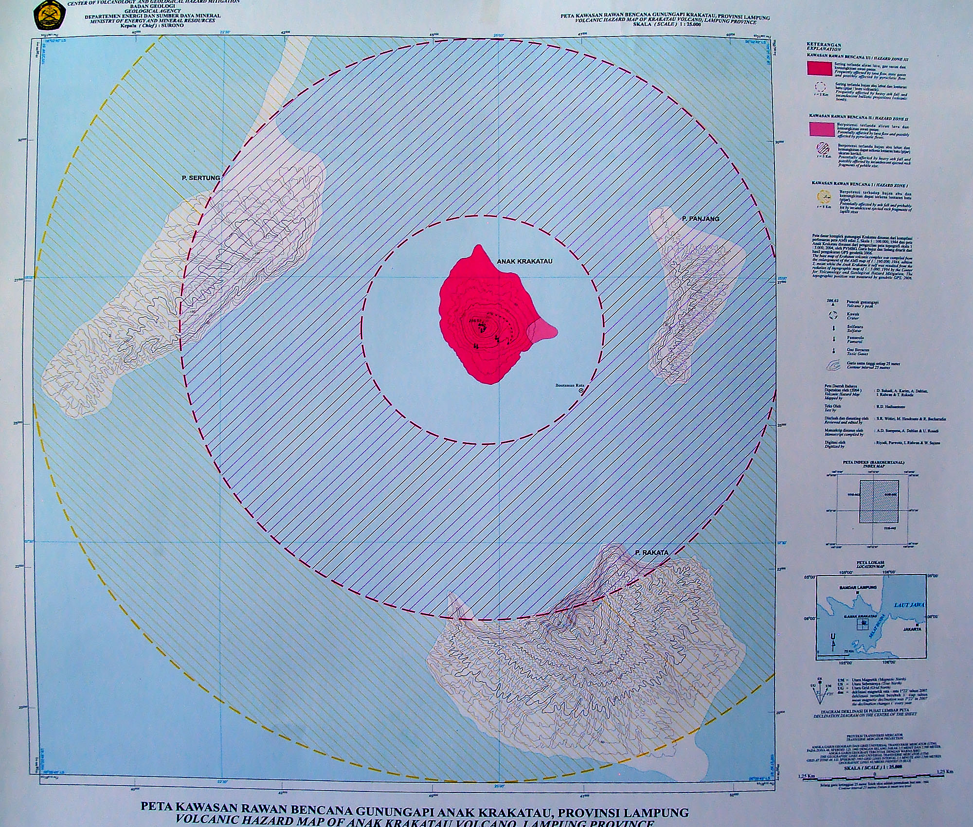
| Satellite image (courtesy NASA image ISS009E12568) of Krakatau Caldera and Sebesi Volcano (area covered approximately 70x50km). Anak Krakatau is partially hidden by clouds. Another topographic map with more datail is availabe here (1MB). |