Montserrat
Maps and Links
Where is everything?
- Simple sketch of Montserrat
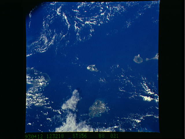
- Space Shuttle Photo of Montserrat (North is right). This small scale image shows the islands around Montserrat, at center before the onset of its current eruption. East (below) of Montserrat is Antigua, where usually volcanologists land to reach Montserrat by ferry. North (right) is the round volcano of Nevis, south (left) the French island of Guadaloupe (NASA Photo).
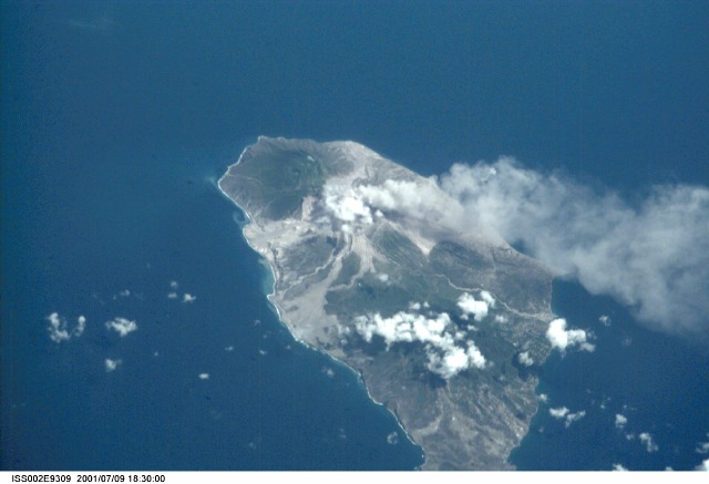
- International Space Station Photo of Montserrat (North is down). The smoke of the active volcano drifts, as usual, towards west (right). The high resolution space photo shows many details: the delta deposited by pyroclastic flows descending through the Tar River Valley (left), pyroclastic flows covering the former Blackburne Airport (lower left), the ghost town of Plymouth (right, covered by the volcano's ash, NASA Photo).
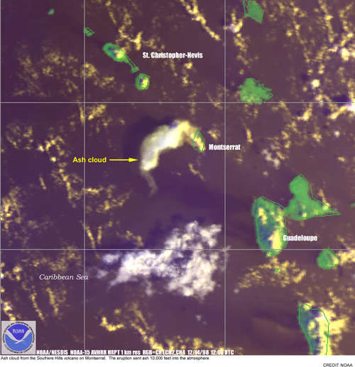
- NOAA/NESDIS Photo of a Montserrat ash eruption (North is up) (NOAA Photo).