Eruzioni inusuali
1.8.2003
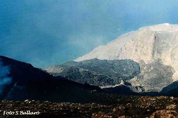
Fine del flusso lavico
5.4.2003
Effetti dell'esplosione
 |
 |
 |
 |
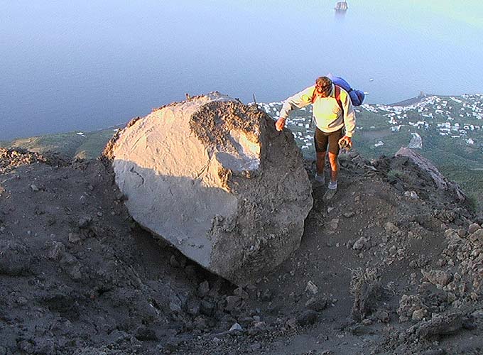
| Bomba di enormi dimensioni e cratere
d'impatto sul Bastimento. Copyright della foto Charles Riviere. |
La stessa bomba, in una foto copyright
Maurizio Ripepe. Sullo sfondo, il paese di Stromboli e Strombolicchio. |
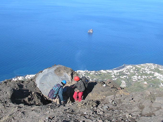
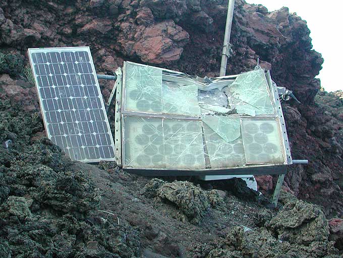
I pannelli solari della nostra stazione
sismica: ecco perchè ora non riceviamo dati ...
Nota le bombe fresche in primo piano. Foto M. Ripepe. |
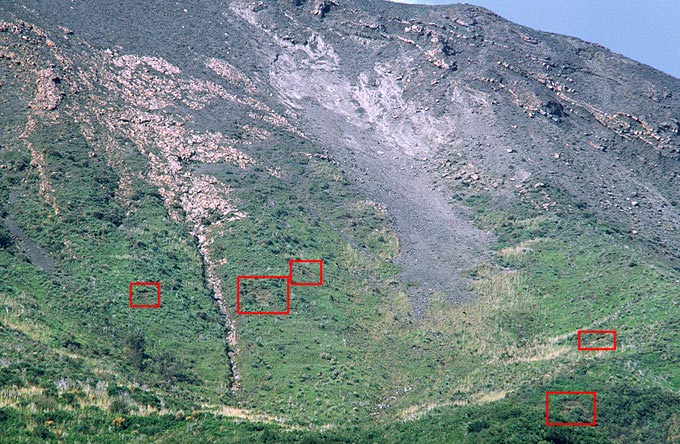
Telefoto dal paese di Stromboli (immagine
fortemente processata per aumentare il contrasto). I riquadri in rosso
delimitano i crateri d'impatto. (JA). |
 |
 |
 |
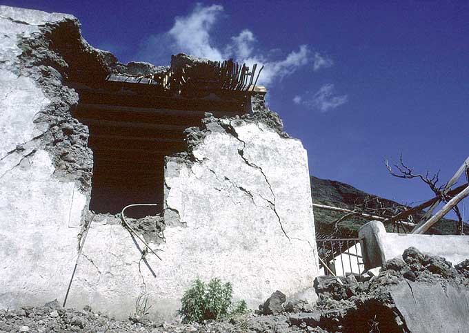 |
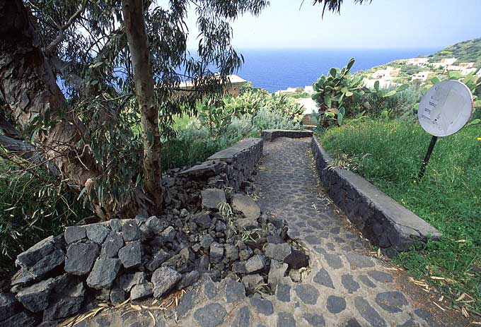
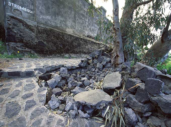
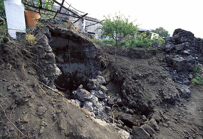
| Cratere sul sentiero che conduce al cimitero di Ginostra. Per la violenza dell'impatto la bomba si è completamente frantumata (JA). | Lo stesso cratere visto dalla direzione opposta. La scritta «Stromboli» sul muro del cimitero indica un vecchio sentiero per il Pizzo (JA). | Qui una bomba ha distrutto una cisterna d'acqua, il muretto di un giardino e un sentiero pubblico, mancando fortunatamente per un pelo la casa a Ginostra (JA). | Abitazione danneggiata a Ginostra. Per fortuna nessuno è rimasto ferito nel corso di questo drammatico evento. Stromboli sullo sfondo (Foto Aeschlimann). |
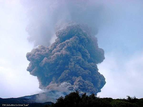
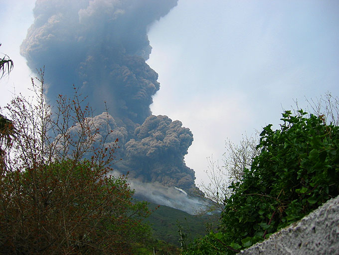
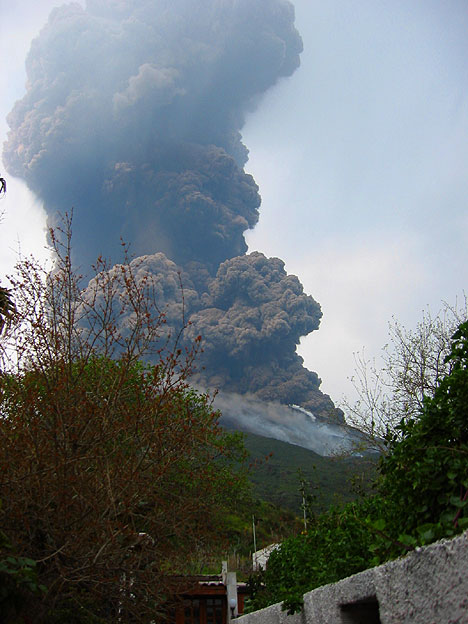
La esplosione
Una forte esplosione si è verificata a Stromboli (Cratere di NE) questa mattina, circa alle 9.15 ora locale (7h15 GMT). Una grande colonna di cenere si è alzata sulla cima per diverse centinaia di metri, e un forte boato è stato udito in paese, assieme a rumore di pietre che cadevano lungo il pendio. La morfologia del cratere ha subito consistenti cambiamenti in seguito all'esplosione.
 |
 |
 |
 |
| Foto scattata da Salvatore Carbone "Sasà" circa un minuto dopo l'esplosione. (ripresa da molto più a destra - ovvero a Ovest - rispetto alle foto successive). La prima foto comparsa in rete dopo l'evento. |
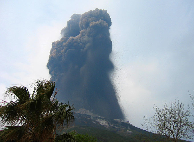
Foto Andreas Franssen ** 9h13 ora locale (7h13 GMT) dal paese di Stromboli. L'ora di questa foto è preso come riferimento T=0sec. per "datare" le foto successive. |
Ingrandimento della foto a sinistra: Migliaia di bombe, alcune singole bombe di notevoli dimensioni all'estrema destra, una in basso a destra poco prima dell'impatto. Vari impatti sul pendio del vulcano. |
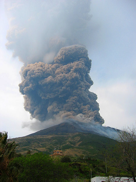
Foto Andreas Franssen T+20sec (tempi relativi ottenuti utilizzando l'orologio interno della fotocamera digitale). La colonna eruttiva in ascesa. |
 |
 |
 |
 |
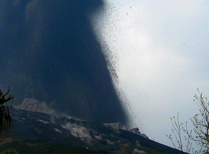
| Foto Andreas Franssen T+43sec. Alla base della colonna eruttiva inizia a crescere una nuova nuvola di cenere (conseguenza dell'impatto delle bombe o di nuove esplosioni?). |
Foto Andreas Franssen T+69sec. La nube eruttiva è salita a grande altezza e la nube "secondaria" la segue. |
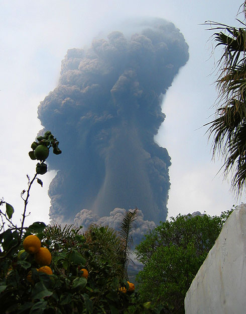
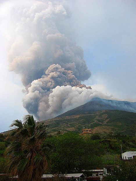
Foto Andreas Franssen T+93sec. Ora anche la nube secondaria è salita di molto. Il fumo sulle pendici del vulcano è causato da piccoli incendi nella vegetazione. |
Foto Andreas Franssen T+111sec. Il vento di NW porta la colonna eruttiva verso SE. E-mail: "Andreas PUNTO Franssen AT t-online PUNTO de". |
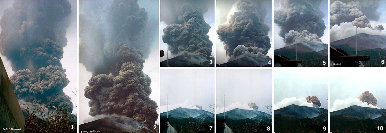 |
Fotomosaico sulla sinistra: Assemblato a partire da una serie di foto forniteci da Sergio Ballarò, Stromboli. Potreste aver bisogno di scorrere la finestra verso destra per vedere tutte le immagini. Foto 1-6; 9-10 (c) Sergio Ballarò. Foto 7-8 (c) Sara Battaglia. | ||
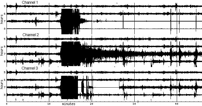
I nostri sismometri hanno rilevato l'evento ma poi uno dei sensori pare essere rimasto danneggiato:
Da un rapporto di Sonia Calvari, INGV, pubblicato sul VOLCANO Listserver:
«On 5 April, at 9:12 am local time, scientists from INGV-CT were doing a helicopter flight for the daily surveys with a portable thermal camera. ... Three vents along this surface were feeding small lava flows, and the summit craters of the volcano were producing a very diluted gas cloud. A few minutes after the start of the survey, the gas plume coming out from the craters and moved west by the strong wind was suddenly crossed by a reddish ash emission, that we interpreted as further collapses within the craters. However, the red ash was soon substituted by juvenile, darker material coming out from crater NE crater. This formed a hot jet with cauliflower shape rapidly growing above the crater. Two or three seconds later, SW crater also produced a hot jet of juvenile material. The eruptive process then evolved very rapidly, with jets from NE and SW craters joining.
A very powerful explosion took place, which pushed the helicopter away from the crater, suddenly increasing its velocity by 30 knots/hour. A mushroom-shaped dark cloud rose from the craters, expanding vertically up to an elevation of about 2 km a.s.l., 1 km above the volcano's summit. The eruptive cloud was surrounded at its base by a dark-grey cloud similar to a base-surge, while it was still expanding vertically and assuming the mushroom shape. Bombs, ash and blocks fell on the NE flank of the volcano above 400 m elevation, causing burning of the vegetation. Most of the ejecta were carried west by the wind. Some fell on Ginostra and damaged two houses. No people were injured by the event.
Continuing the helicopter survey after the paroxysm, we could observe that the lava flow field on the upper Sciara del Fuoco was completely covered by a brown carpet of debris ejected from crater 1 during the initial phase of the event. A very thick steam cloud was rising from this site, suggesting vaporisation of wet material above the still active lava flows. In the meanwhile, several alternating black and reddish pulses were taking place, mainly from SW crater. Several fingers of light-brown debris were expanding from the NW flank of NE crater along the middle part of the Sciara del Fuoco. The upper part of the volcano above 700 m elevation was completely covered by a continuous carpet of pyroclastic products. Pizzo Sopra La Fossa showed on the north flank a number of new fractures concave towards north and extending between the summit of the volcano and the south base of NE crater. The presence of these fractures makes it possible that new landslides can occur on the summit of the volcano.
Within a few minutes from the start of the paroxysm, the upper Sciara del Fuoco showed active flows emerging from the carpet of debris covering the lava flow field. The explosive event caused abundant emission of the so-called "golden pumice" mixed with little brown scoria. ... A helicopter survey carried out on 8 April showed four active vents pouring out lava on the upper Sciara del Fuoco at 590 m a.s.l.. Two of the flows were expanding along the middle Sciara del Fuoco, causing detachment of blocks from the flow front and little rock falls reaching the sea. Within the summit craters a thick carpet of debris has accumulated following the paroxysm of 5 April. This has reduced the craters depth of about 50 m thickness, causing partial obstruction.»
Marzo 2003
 |
 |
 |
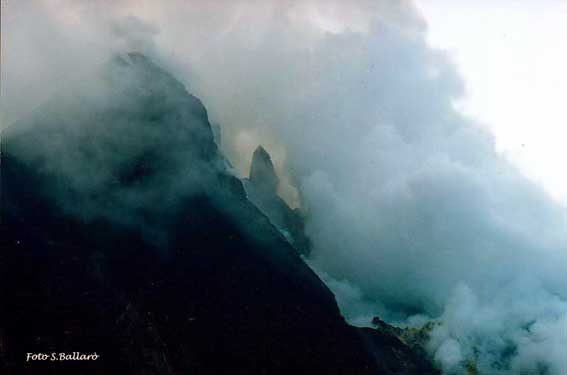
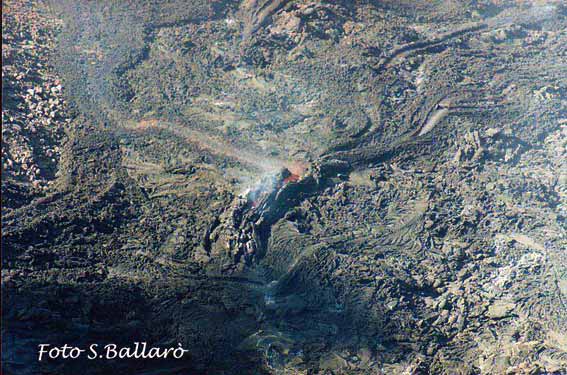 |
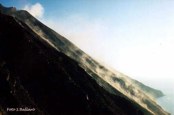
| Foto Sergio Ballarò. Lungo il ripido pendio della Sciara, il fumo sollevato dalle piccole frane che scendono quasi senza soluzione di continuità. | Foto Sergio Ballarò. La morfologia del cratere di NE è molto cambiata. In mezzo una struttura simile ad un dicco. | Foto Sergio Ballarò. Una visione panoramica del campo lavico dell'eruzione 2002-2003. | Foto Sergio Ballarò. Dettaglio di una delle bocche effusive all'interno del pianoro formatosi sotto il cratere di NE. |