Sakurajima and Kirishima
Maps and Links
Where is everything?
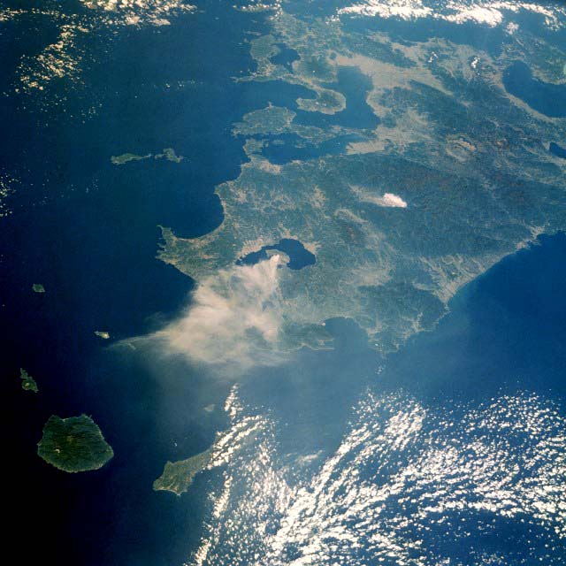
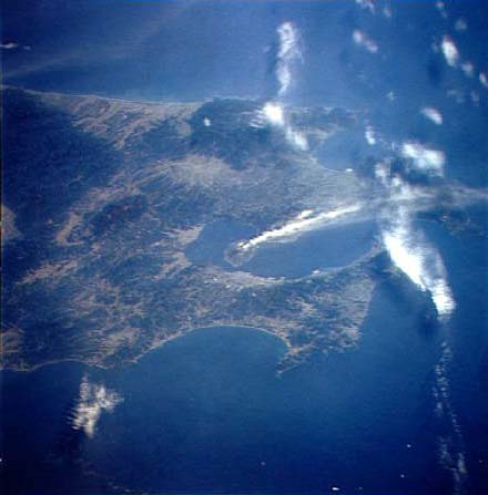
- Space Shuttle Photo of Southern
Kyushu (North is up. Sakurajima Volcano smokes towards South. Kirishima volcanoes at the upper center image rim, 50 km NNE of Kagoshima, which is left of Sakurajima. NASA Photo)
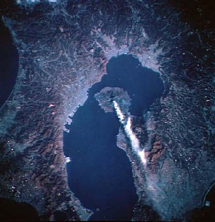
- Space Shuttle Photo of
Kagoshima Bay (North is up. Closer view of Kagoshima with Sakurajima smoking towards SSE. NASA Photo)
- Space Shuttle Photo
of Southern Kyushu (North is up-right. At the beginning of 1986 the Sakurajima Volcano was very active, with huge ash clouds erupted towards SE. Note how Kyushu is free of clouds, which cover the Chinese Sea at left: an usual winter weather which ensures perfect night skyes in Kyushu. NASA Photo)
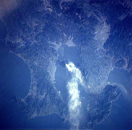
- Space Shuttle Photo
of Southern Kyushu (North is left. On 22 October 1989, a huge ash eruption is occurring on Sakurajima while the Space Shuttle is reaching Kyushu. NASA Photo)
- Space Shuttle Photo
of Southern Kyushu (North is up-right, better resolution. While the Space Shuttle flies over Kuyshu, the big ash eruption continues. NASA Photo)
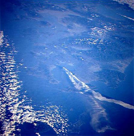
- Space Shuttle Photo of
Southern Kyushu (North is left. The day after, a dense steam plume is erupted towards south. Note the cloud shadows on the sea. NASA Photo)