Braided rivers and morainesAnother spectacular feature of the Tasman Glacier is its huge braid plain. The river originates in the Tasman Glacier Lake and
terminates as a large delta in Lake Pukaki. This lake may once have extended as far as the Tasman Glacier Lake, but the continual
supply of sediment from uplift of the Southern Alps and transfer by glaciers and rivers has filled the head of the lake for
several kilometres. Lake Pukaki itself occupies a basin that was carved out by Pleistocene glaciers, and is now dammed by
moraines that date from the Last Glacial Maximum of around 15,000 to 18,000 years ago, and even earlier glaciations. |
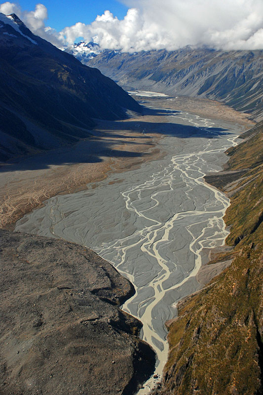 Murchison River flows toward the left-lateral moraine of Tasman Glacier at the bottom. Areas of grey sediment
represent the active bed of the river during flood conditions, brown vegetated areas are only occasionally
subject to flooding ( April 2008). | 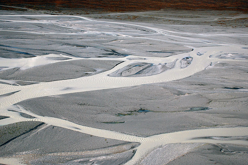 Network of branching channels with intervening sand and gravel bars characterises the braid-plain
of Tasman River (April 2008). | 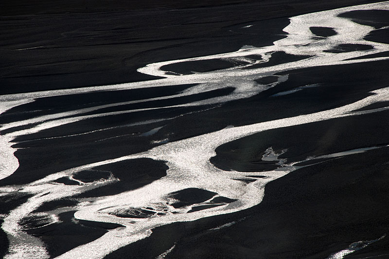 Sunlight reflected in these Tasman River channels emphasises the morphology of the intervening bars
(April 2008). | 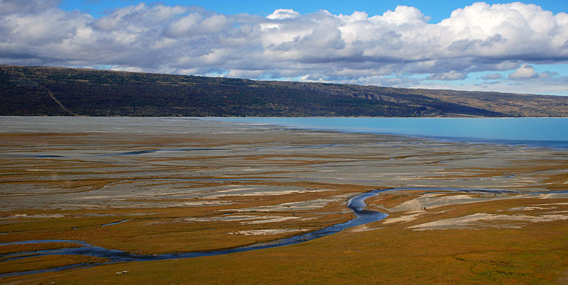 The Tasman River delta from the air and the turquoise waters of Lake Pukaki. The colour is due
to suspended sediment in the water which reflects the light. The brown areas are grassed over and stabilised. |
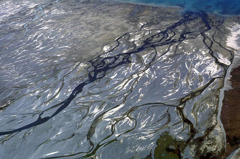 A higher level aerial view of the braid-plain of Tasman River and its entry into Lake Pukaki (top).
Active channels are dark-coloured, and the light-coloured bars are composed of sand, with gravel elsewhere. | 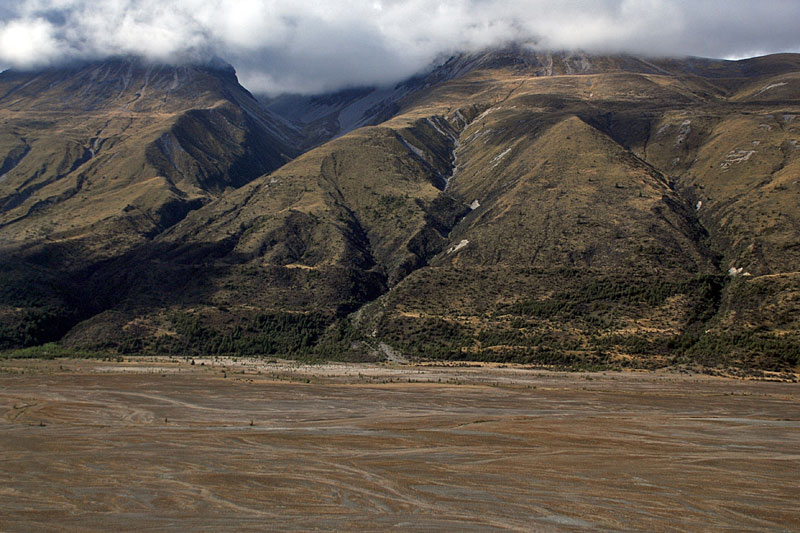 A relatively stabilised part of the Tasman braid-plain with the steep slope of the Burnett Mountains
above. These slopes carry a series of parallel but gently inclined terraces which are the remnants of lateral moraines; the lower pair are
early Holocene in age, whereas the upper ones date are Late Pleistocene. | 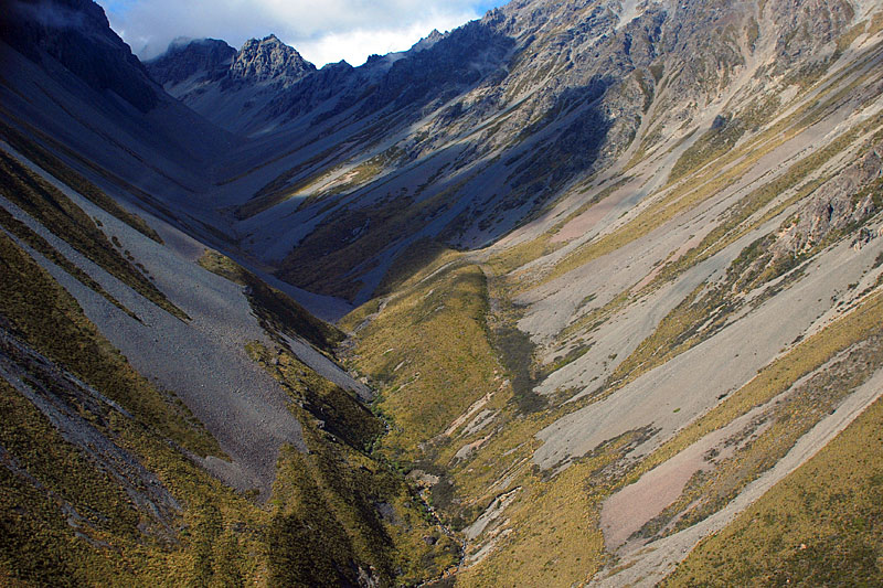 The valley of Chop Creek in the Burnett Mountains hangs above the Tasman Valley. The lateral moraines,
partly over-run with scree, indicate that this valley carried a small narrow Late Pleistocene glacier. | 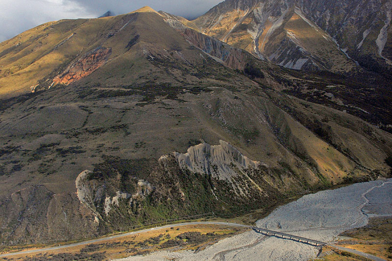 Alluvial fan on the west flank of Tasman Valley that is the product of snowmelt and rain. Above and left
of the road bridge are a series of lateral moraines. The light scar indicates that there is a thick drape of glacial sediment (till) on this slope. |
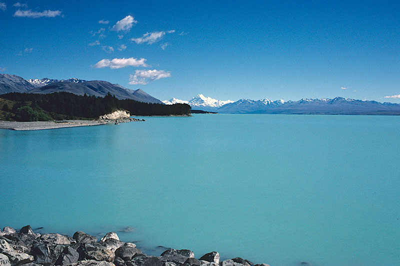 Suspended sediment gives rise to the turquoise hue of Lake Pukaki, as viewed here from the
Pleistocene terminal moraine complex. Aoraki/Mount Cook (3754 m) is the high peak in the background. Good sections through the moraine sediments occur on the shore to the left, easily reached by way of a short walk. | 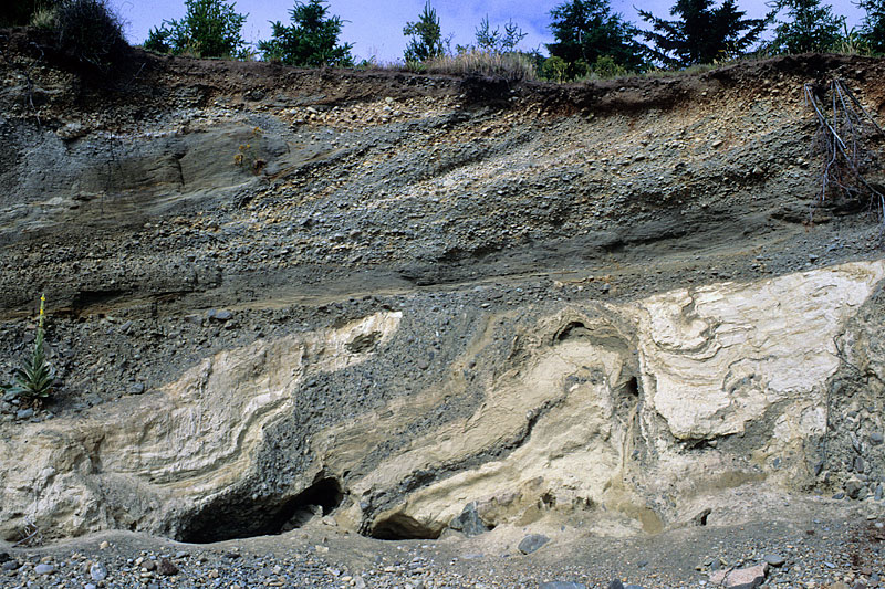 Complex interbedding of sand and gravel of glaciofluvial origin, and glaciolacustrine silts are evident in this 8-10 m-high
section through the Late Glacial Maximum moraine at the south end of Lake Pukaki. The strong deformation in the lower half of the section is the
result of either ice-push or ice over-riding. | 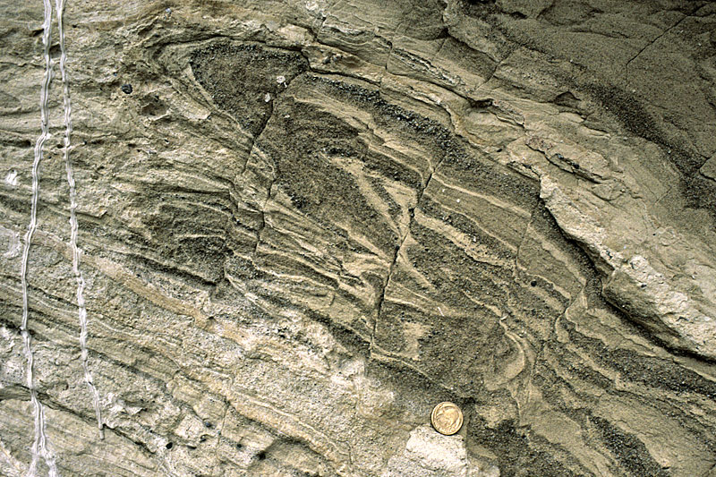 Recumbent fold and faulting in laminated glaciolacustrine silt and sand. The sediment appears to have quite ductile when it
was folded, but brittle when the later faulting occurred. Ice-push, ice-over-riding and slumping have all been invoked to explain these features. | 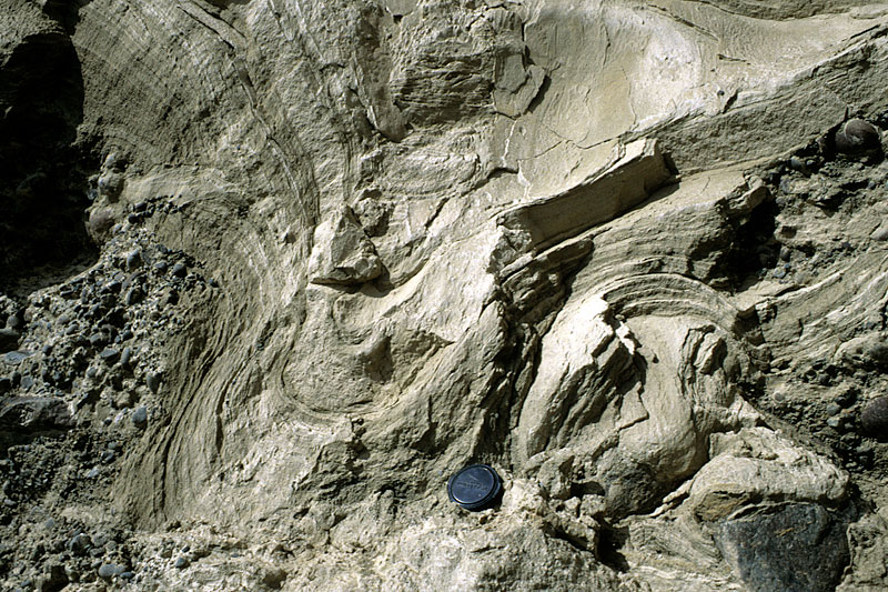 Laminated silt and sand were deposited on top of gravel, and then subsequently folded into this synclinal structure, by processes
in previous illustration. |
| Several sets of lateral moraines also drape the flanks of the valley. The relatively sparse vegetation (mostly grassland and some
forestry plantations) means that unlike on the West Coast, the glacial geomorphology is superbly exposed. Lake Pukaki has been
raised to generate hydro-electric power. When the water level is low, it is possibly to see the internal structure of the
Pleistocene moraines as wave action has eroded cliffs in the semi-consolidated sediment.
Photos Michael Hambrey (rows 1 and 2) and Jürg Alean (row 3). |