Taylor Glacier, Dry Valleys, Antarctica
Taylor Glacier originates on the Polar Plateau, that is the East Antarctic Ice Sheet, and flows about 50 km into Taylor Valley, the best-known of the major desert-like valleys in the region. The glacier terminates in saline Lake Bonney that has a perennially frozen surface that exudes salt. Many studies have been made on this glacier, the lake and the valley below by New Zealand and American scientists. The region as a whole is a Specially Protected Area with extremely strict environmental controls that require scientists not to leave any trace of their presence. Taylor Glacier is predominantly a cold glacier, but is partially wet-based where it flows into the Lake Bonney basin, resulting in some sediments that are more akin to those of polythermal glaciers (as in Svalbard). Taylor Glacier was discovered during Scott’s First (Discovery) Expedition (1901-1904), and explored by Australian geologist Griffith Taylor during the second expedition in 1910. Scott subsequently named the glacier after Taylor.
|
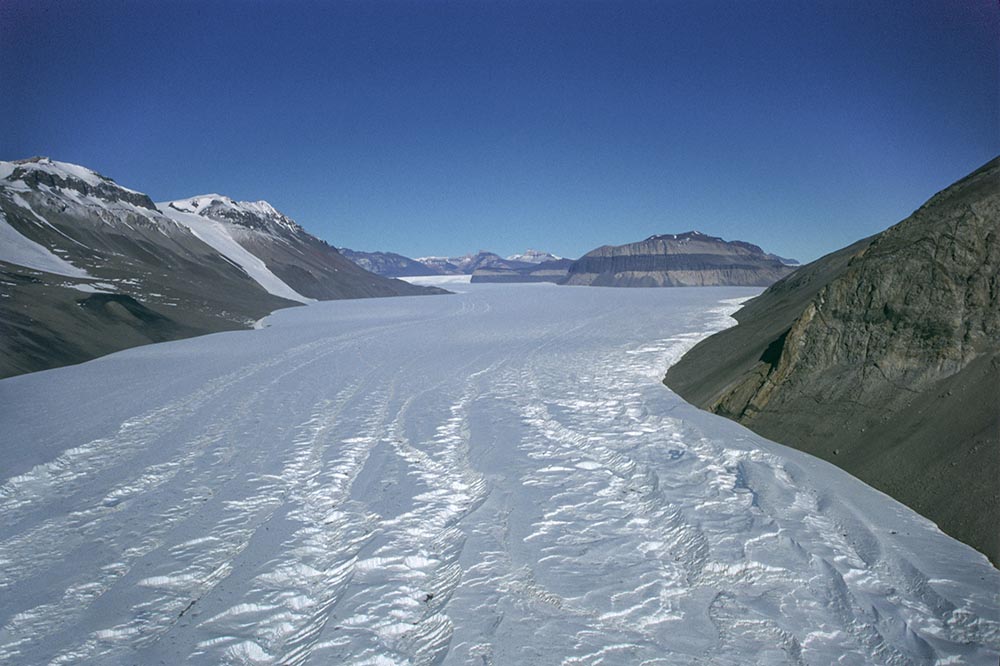
Aerial view of the middle and upper reaches of the glacier, showing converging flow in the background.
| 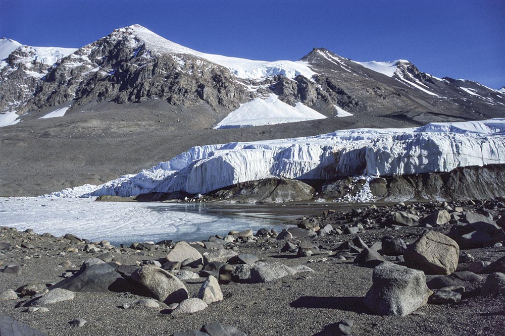
The snout of Taylor Glacier, partly terminating in Lake Bonney. Changes to the snout are slow in this frigid desert environment. Glacially transported boulders in the foreground are etched by wind-action. An avalanche-fed rejuvenated glacier, Calkin Glacier, can be seen in the background.
| 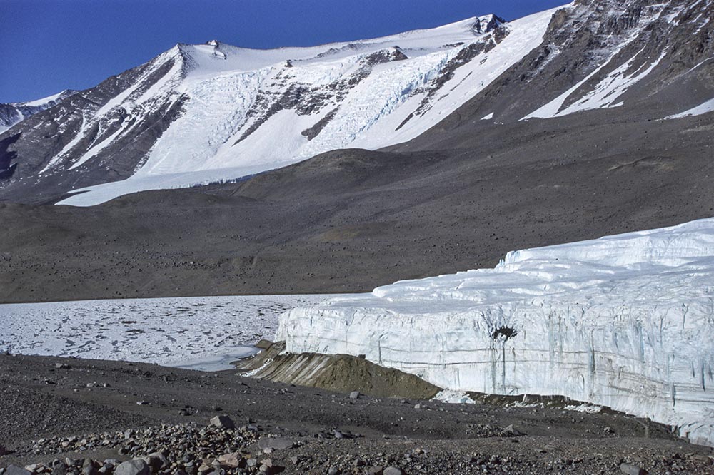
The true left side of Taylor Glacier with frozen Lake Bonney with Hughes Glacier spilling out from a cirque beyond. Note the sharp boundary between Taylor Glacier ice and the debris-draped ramp beneath; we infer this to be a thrust-fault.
| 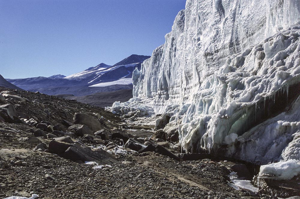
A close-up view of the true-left margin of Taylor Glacier, showing dry calving of the ice cliff and the bouldery debris deposited my a much earlier glacier advance.
|
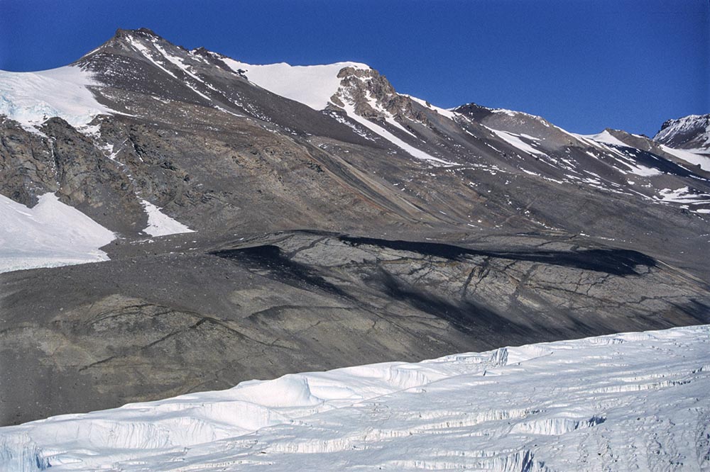
A low-level aerial view of the surface of Taylor Glacier and other glaciers on the mountainside to the south. Of geological note here are the ice-eroded lower slopes where a series of black basalt dykes and volcanic cones of Cenozoic age intersect the basement rocks.
| 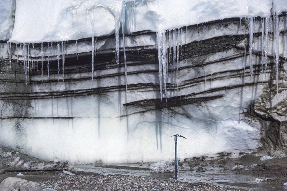
The contact between the glacier and its bed at the left margin, illustrating intermittent debris layers, one of which (above the ice axe) is tightly folded.
| 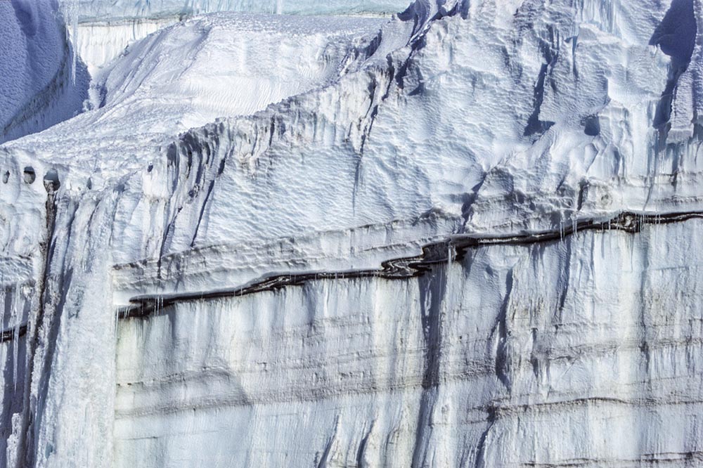
Some basal debris layers reach a high-level position in the ice cliff by repeated folding or thrust-faulting. This layer is itself folded with the fold hinges overturned towards the left, in the direction of ice flow. A small frozen waterfall is present on the left.
| 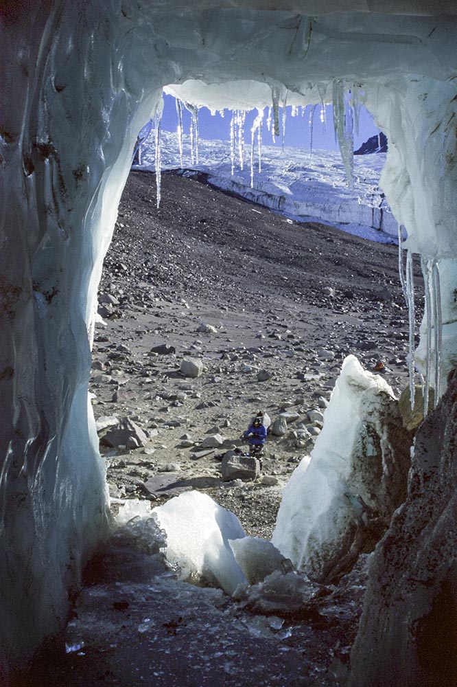
To investigate the nature of the basal transition, a tunnel was excavated in the base of Taylor Glacier by Prof. Sean Fitzsimons, using a chainsaw. This is the view looking out of the tunnel at the debris-strewn slopes adjacent to the left margin of the glacier.
|
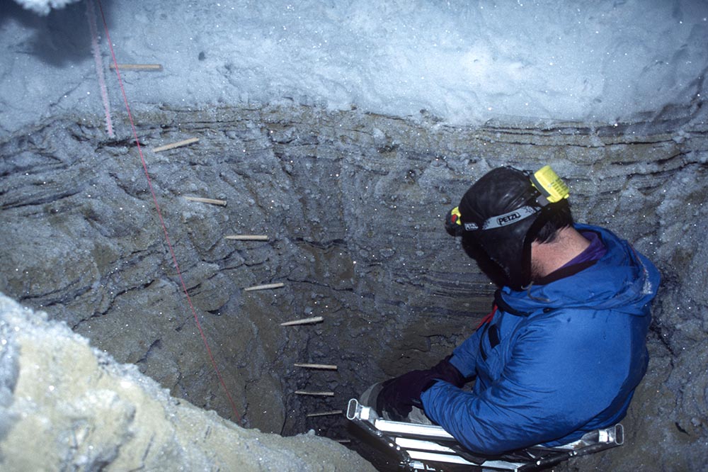
Inside the tunnel, Sean has cut down into the basal debris layer to sample the sediment and to measure deformation using a series of pegs. A chilly place to work, several degrees below zero!
| 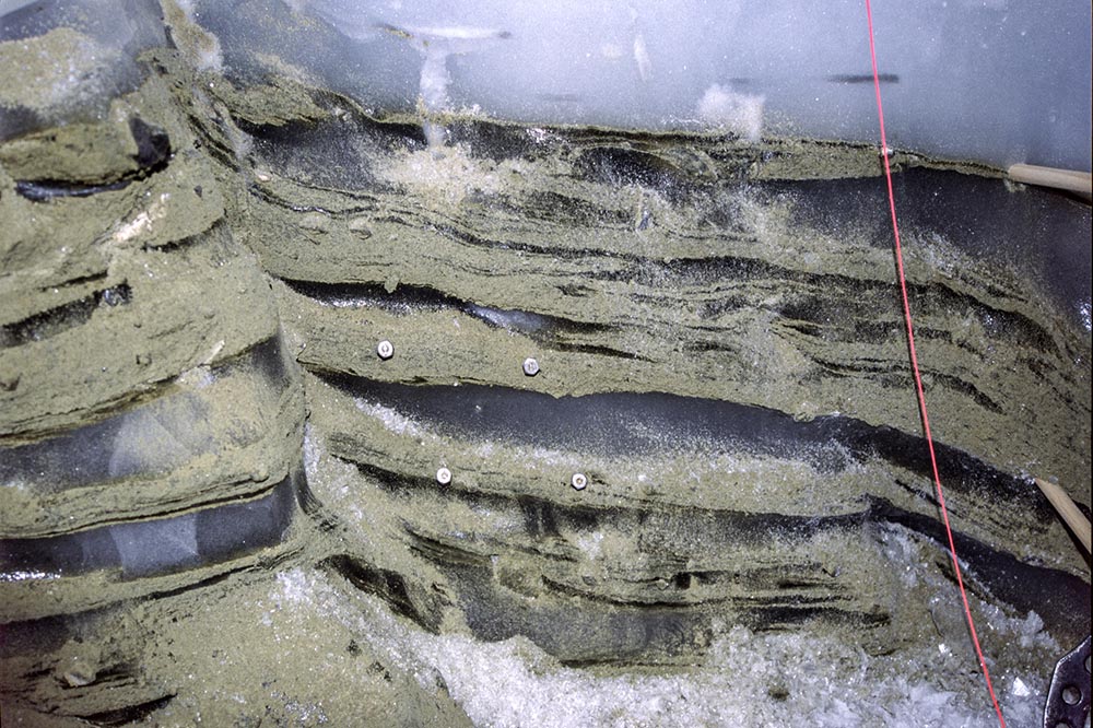
The basal debris here is dominated by strongly sheared layers of sand, interbedded with clean ice. A fault runs through the left side. The four pegs formed a square when first inserted, but shear to the left has transformed the geometry into a parallelogram.
| 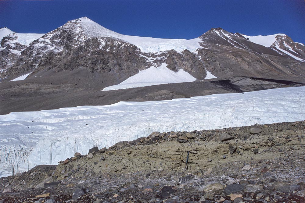
The slopes above the true left bank of Taylor Glacier, reveal areas of old sandy diamicton, that is quite consolidated (or "lithified"). We interpreted the deposit as a till from a wet-based glacier, but the age is unknown; it could be a few million years old as it resembles dated sediments that have been recovered in nearby boreholes. Calkin Glacier is in the background.
| 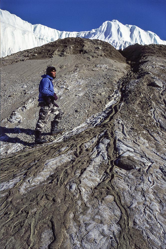
A prominent ramp of sediment (sandy gravel, sand and mud) at the snout of Taylor Glacier, with a gully formed by water run-off. When water is flowing it stains the sediment red, hence giving the location the name "Blood Falls". American scientists have determined that the water is iron-rich, saline, and of marine origin. It contains a diverse subglacial bacterial assemblage.
|