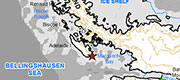
The Peninsula is the long arm of the Antarctic continent that stretches for about 1700 km from Ellsworth Land in West Antarctica, towards South America. Its northern extremity lies far north of the Antarctic Circle, beyond which are groups of islands including the South Shetland Islands and the South Orkney Islands, whilst to the east lies James Ross Island. The peninsula is mountainous, and although narrow, carries a substantial ice sheet that joins with the West Antarctic Ice Sheet in the south. The northern part is known as Graham Land, and the southern part Palmer Land. To the west of Palmer Land is Alexander Island, the worlds largest uninhabited island; these two areas are linked by the George VI Ice Shelf (continued below the thumbnails).
Antarctic Peninsula (Southwest)
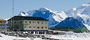
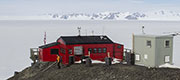
Rothera Base
Rothera Base [more]
Location map
Antarctic Peninsula map [more]
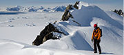
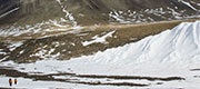
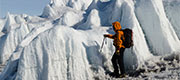
Field training
Preparing for fieldwork in Antarctica [more]
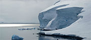
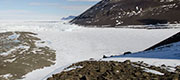
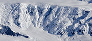
Wormald Ice Piedmont
Wormald ice piedmont [more]
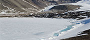
Ablation Valley and Lake
Ablation Valley and Lake [more]
Ablation Valley Glacier
Ablation Valley Glacier [more]
Erratic Valley and Glacier
Erratic Valley and Glacier [more]
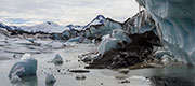
Moutonnée Lake
Moutonnée Lake [more]
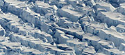
Structures
George VI Ice Shelf structures and morphological features [more]
Lakes and ponds
George VI Ice Shelf: lakes and ponds [more]
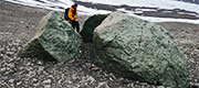
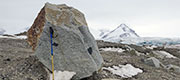
Moraine features
George VI Ice Shelf: moraine features [more]
Tributary glaciers
George VI Ice Shelf tributary glaciers [more]
Moraine features
Fieldwork at Fossil Bluff [more]
Palmer Land
Aerial photos of Palmer Land [more]
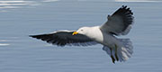
Other birds
Wildlife: other birds [more]
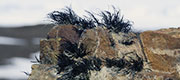
Other organisms
Wildlife: other organisms [more]
Other extensive ice shelves fringe the Antarctic Peninsula, but many have disappeared in recent decades, including the Wordie, Prince Gustav, Larsen A and Larsen B ice shelves. Glaciologists believe that those remaining are also vulnerable to collapse. These changes reflect the rapid temperature rises in the Peninsula region, which are amongst the highest in the world and are a clear indication of anthropogenic global warming. Although ice-shelf collapse does not directly result in rise in sea level, the resulting "undamming" of the interior glaciers releases more ice into the sea; enhanced velocities derived from satellite data have demonstrated this process.
Our field operations have focused on James Ross Island in the northeast, and Alexander Island in the southwest. Our most recent research is entitled "Glacial history of the NE Antarctic Peninsula Region over centennial to millennial timescales". The UK Natural Environment Research Council (NERC) funded the project. Logistical support was provided by the Royal Navys HMS Endurance and HMS Protector (in the northeast) and the British Antarctic Survey (northeast and southwest). Further information is available on Antarctic Glaciers, which highlights some of our results and work activity.
Our field operations have focused on James Ross Island in the northeast, and Alexander Island in the southwest. Our most recent research is entitled "Glacial history of the NE Antarctic Peninsula Region over centennial to millennial timescales". The UK Natural Environment Research Council (NERC) funded the project. Logistical support was provided by the Royal Navys HMS Endurance and HMS Protector (in the northeast) and the British Antarctic Survey (northeast and southwest). Further information is available on Antarctic Glaciers, which highlights some of our results and work activity.