Antarctica: the icy continentHuman experience of glaciers is mainly limted to mountain glaciers that are easily accessible, but by far the greatest mass of ice on Earth is the Antarctic Ice Sheet, which reaches a thickness of nearly 5 km. If the entire ice sheet melted, sea level would rise globally by some 60 metres. These images illustrate the scale of the ice sheet and its component parts, such as ice streams and ice shelves, as well as the mountains that rise above the ice cover. |
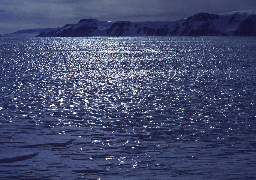 Mill Glacier is one of the major tributaries of the Beardmore Glacier and illustrates the wind-polished ice surface that makes travelling on foot or ski treacherous. MH | 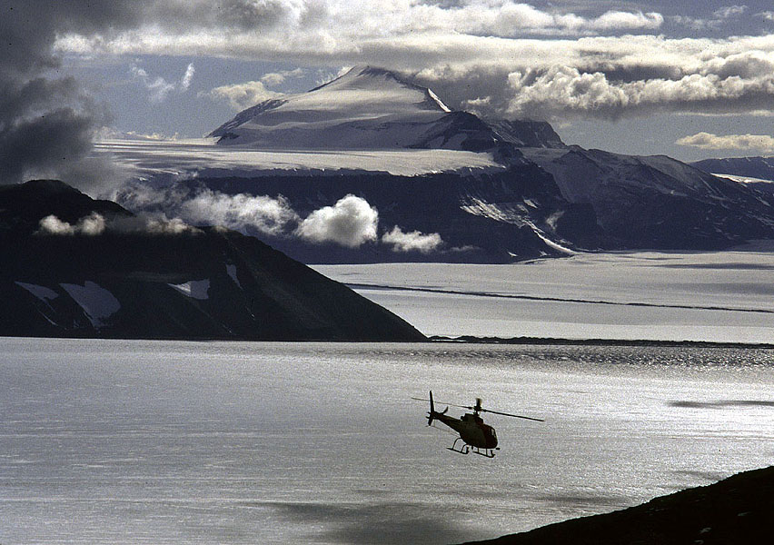 A helicopter of the United States Antarctic Program flies over Shackleton Glacier, central Transantarctic Mountains in support of a field party. MH | 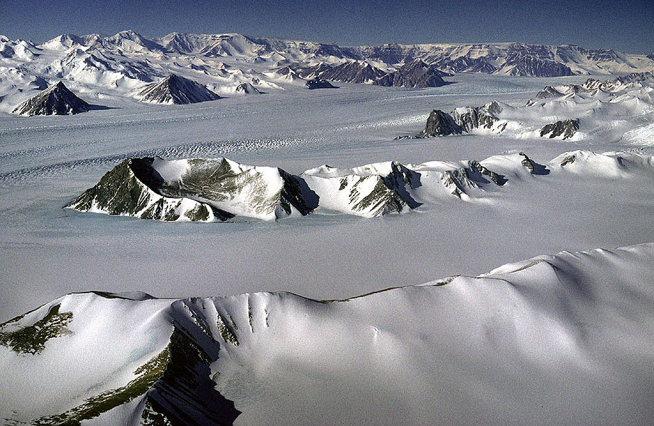 Amundsen Glacier is one of many huge valley glaciers that carve their way through the central Transantarctic Mountains from over 3000m altitude and flow into the Ross Ice Shelf at sea level. MH | 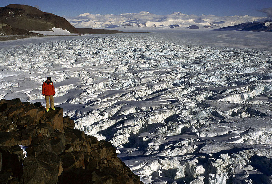 Shackleton Glacier is one of many glaciers that originate in the East Antarctic Ice Sheet and slice through the Transantarctic Mountains, before merging in the Ross Ice Shelf, close to sea level. We are looking across a field of heavy crevasses, downglacier towards Mount Wade. MH |
 Amery Ice Shelf is a major floating slab of glacier ice, underlain by marine ice frozen onto the bottom, fed by arguably the world’s biggest glacier, the Lambert. Here we are looking across the inner reaches of the ice shelf from Fisher Massif, a 1700 m high nunatak along the Lambert Glacier’s western flank. MH | 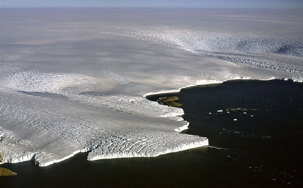 Most of the discharge from the East Antarctic Ice Sheet is via ice streams, zones of fast-flowing ice between ice that is frozen to the bed. Crevasses mark the boundary with slow-moving ice, and the ice streams themselves are themselves heavily crevassed and show how the ice is drawn-down by faster flow. MH |  Constant freeze-thaw of ice in spring results causes huge icicles to form, as here at the front of Mackay Glacier, western Ross Sea. MH | 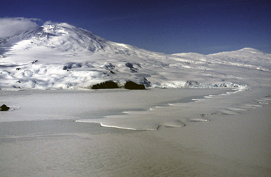 Floating extensions into the sea of valley glaciers are termed glacier tongues. Here, the Erebus Glacier tongue with its saw-toothed flanks, flows off Mount Erebus into McMurdo Sound. Smooth snow-covered sea ice surrounds the tongue on all sides. MH |
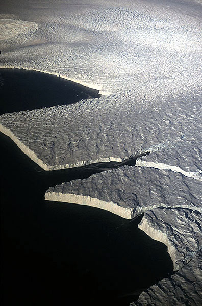 Ice shelves are floating slabs of glacier ice, and commonly show advance and recession unrelated to climatic change. They undergo slow build-up and expansion over many decades, followed by calving of huge icebergs within a few months. This ice shelf shows in miniature how some of the exceptionally large icebergs form. MH |  Two views of the Ekstroem Ice Shelf, East Antarctica (above and above right). The upper surface near its edge is marked by a knobbly icy surface – the result of storm waves throwing up spray that freezes as a crust on the surface. MH |  The above photograph illustrates the shelf edge, marked by an undercut cliff, rising about 30 m above water level, while a few more hundred metres of cliff extends below the water-line. MH |  Satellite image of the Larsen Ice Shelf. The shelf is undergoing catastrophic collapse during February and March 2002, following decades of rising temperatures in the Antarctic Peninsula region. Multi-angle imaging radio spectrometer instrument aboard TERRA satellite. (Image courtesy NASA). |
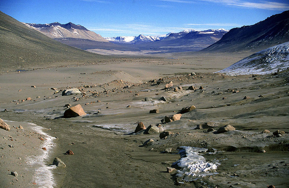 Where the East Antarctic Ice Sheet fails to reach the coast, perhaps because it is blocked by mountains, conditions are so dry that there is less precipitation than tropical deserts. Sand dominates the once-glaciated terrain. Here, the Victoria Lower Glacier flows inland from a coastal icefield, terminating in this dusty basin. The limited meltwater also drains inland before evaporating. MH |  Most glaciers in the Dry Valleys are cold-based, but nevertheless rework the underlying sediment and rock, while trickles of meltwater cause a certain amount of fluvial erosion. Hughes Glacier is self-contained mountain glacier high above Lake Bonney, the surface of which is frozen and saline; like many lakes fed by glacial meltwater in this region, the lake has no outlet. MH |  Among the earliest glaciological studies in Antarctic were those undertaken by the British expeditions of Scott in the early years of the 20th Century. Scott’s second but ill-fated expedition established this base at Cape Evans in McMurdo Sound, seen during the tail-end of a blizzard. Barnes Glacier in the background is a cliff grounded on the sea floor. MH |  Beardmore Glacier, slicing its way through the Transantarctic Mountains, is one of the major overland highways to the South Pole from the Ross Ice Shelf. The route was pioneered by Shackleton in 1908, and followed by Scott in 1911-12. Mount Kyffin (1604 m) marks the entrance to the glacier, which here is heavily crevassed as it joins the ice shelf, illustrating the severe challenges faced by the early explorers. MH |
 Small manoeuvrable vessels such as the James Caird are often used to enhance hydrographical and marine surveys undertaken by their larger host vessels in iceberg-infested waters, such as HMS Endurance. Snow Hill Island, northern Antarctic Peninsula is in the background. MH | 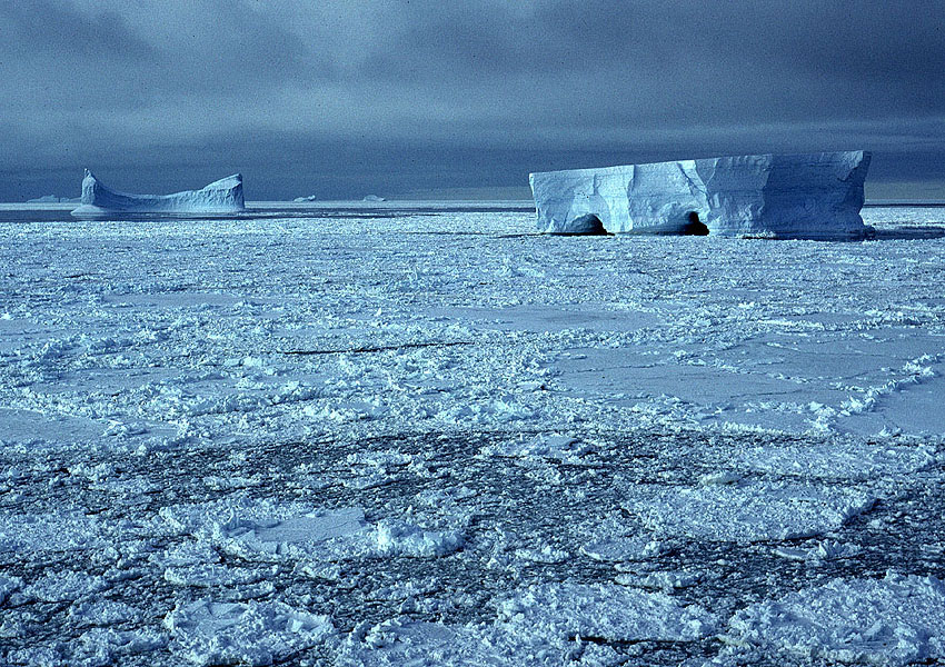 Tabular iceberg in the early stages of decay off Mawson Station, Mac. Robertson Land, East Antarctica. Waves have excavated two caves at the waterline in one of the bergs. The sea ice around the bergs is freshly formed and heralds the onset of winter conditions in March. MH |  The East Antarctic ice sheet produces vast quantities of tabular icebergs, some the size of small countries. In this aerial view of the coast of Coats Land, eastern Weddell Sea, we see a number recently calved icebergs, each measuring a few hundred metres in length. Note how the bergs tilt; this indicates the early stages of disintegration. MH | 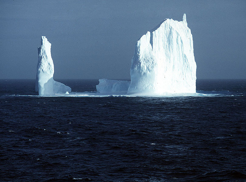 Drifting far beyond the Antarctic coastline in the Southern Ocean are bergs in various stages of decay, some maintaining their tabular form, others overturning and acquiring irregular shapes. MH |
| Photos: Michael Hambrey (MH), Jürg Alean (JA) |