Tiefengletscher: repeat and aerial photosTiefengletscher is a small mountain glacier on the east flank of Galenstock (3586m), canton Uri, Switzerland (surface area in 2016: 2.17 square kilometres). Recession of the tongue led to the emergence of a new proglacial lake. The glacier tongue became separated from the main part of the glacier in 2016/17. In 2021 the remaining dead ice still calved into the lake and showed signs of rapid collapse.
|
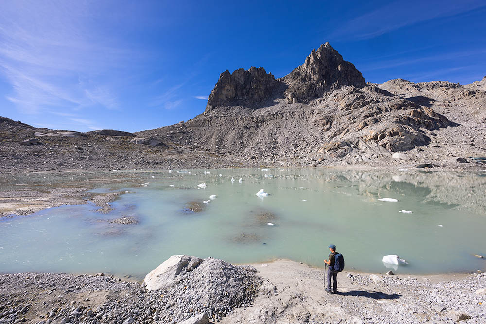 New proglacial lake of Tiefengletscher with Chli Bielenhorn in the beackground (August 2022). | 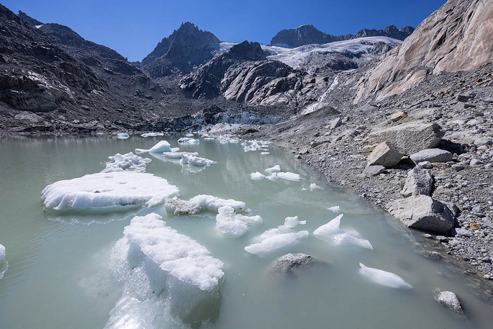 Newly-calved icebergs in front of Tiefengletscher; Gross Bielenhorn (centre left) and Galenstock (centre right) in the background (August 2022). | 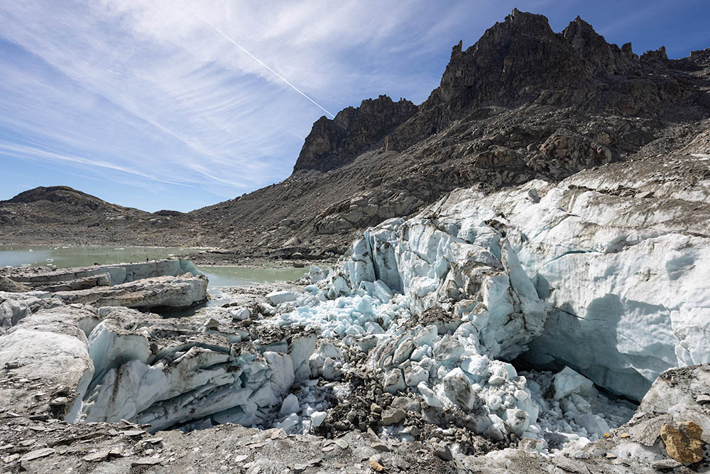 Collapsing remnant glacier behind the glacial lake. Note person on the left. | 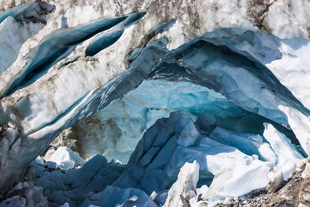 Ice arch in the calving front of Tiefengletscher (August 2022). |
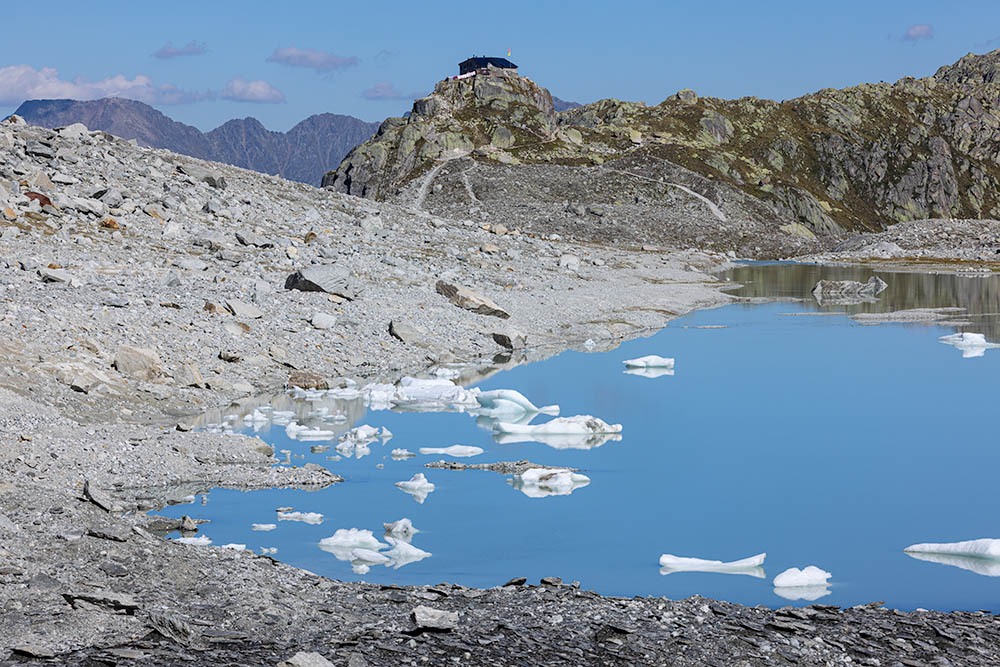 View over the proglacial lake towards Albert-Heim-Hütte (SAC, 2022). | 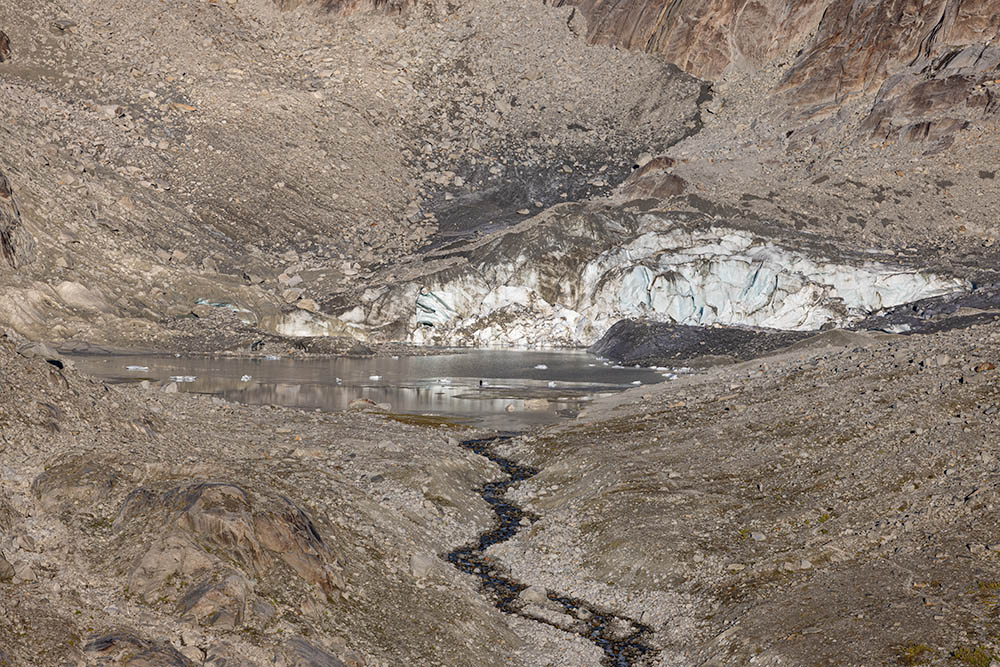 View from Albert-Heim-Hütte towards Tiefengletscher soon after sunrise (August 2022). | 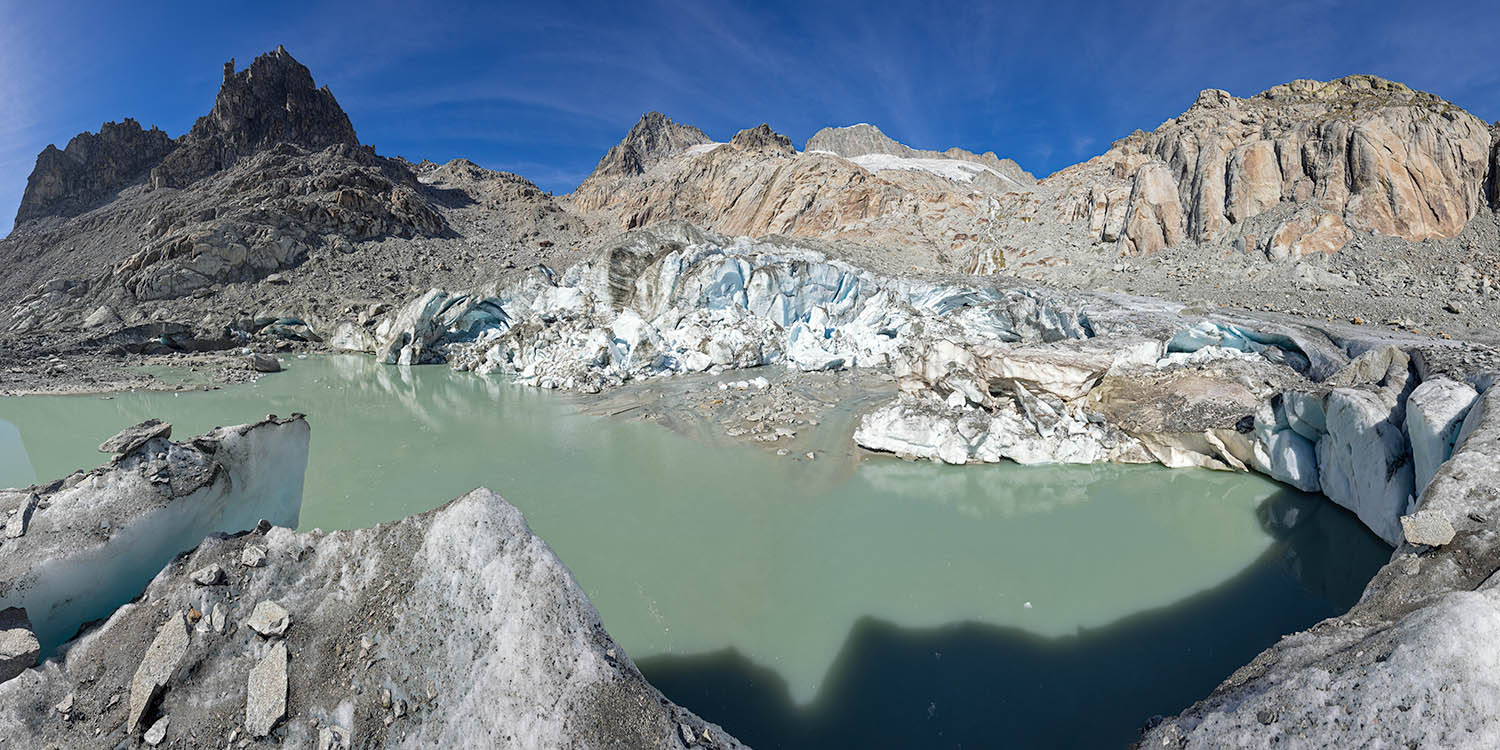 Panorama photo of Tiefengletscher with Gross Bielenhorn und Galenstock in the background (centre, 2022). | 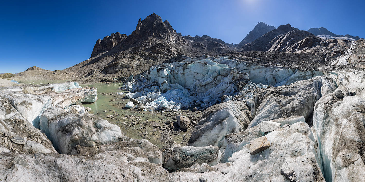 Panorama photo of Tiefengletscher with Tiefengletscher with Chli and Gross Bielenhorn in the background (2022). |
 Repeat photos of Tiefengletscher and the Albert Heim Hut from a ridge about 150m east of the hut. Left photo: sometime after 1918 (when the hut was opened, unknown photographer). Right photo: September 30th, 2021 after the hut was extended on the right. The new proglacial lake is just barely visible at centre-left. | 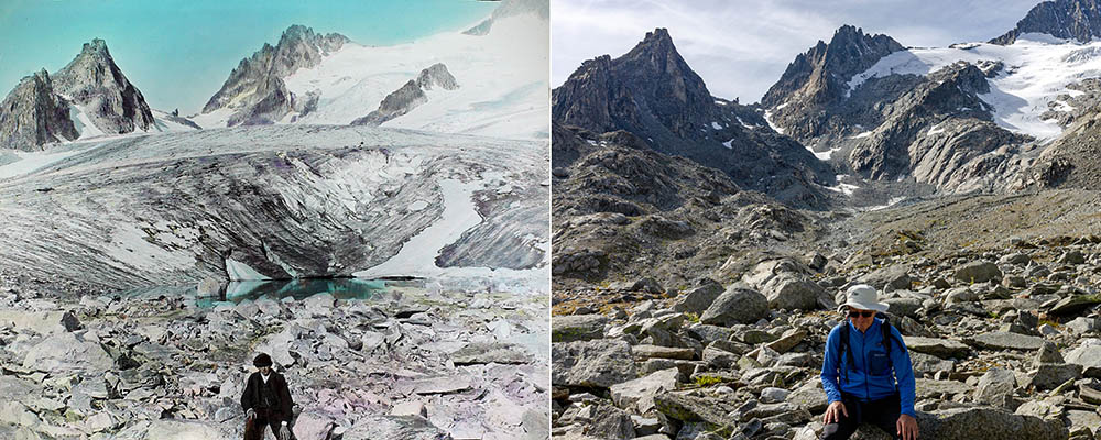 Tiefengletscher in 1909 with small ice-dammed lake (photo L. Wehrli, artificially coloured b&w photo) and on September 30th, 2021 from a similar position. The proglacial lake is not visible from this location. | 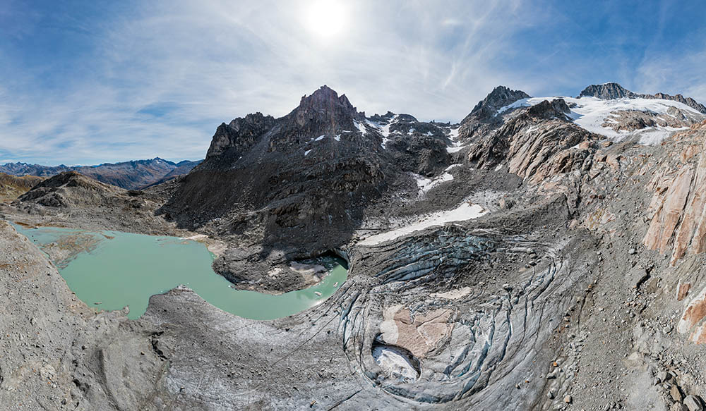 Drone panorama September 30th, 2021. Chli Bielenhorn (2940m) is at centre left, and to the right of this peak Untere Bielenlücke and Gross Bielenhorn (3211m), with Galenstock (3586m) at the far right. Note concentric crevasses indicating collapse within the dead ice. |  Calving front of the remnant glacier at the back end of the proglacial lake (30.9.2021). |
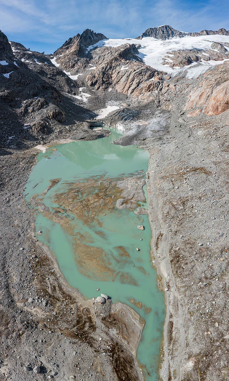 Vertical drone panorama of the new proglacial lake as seen from the east. In the nearest part of the lake a delta-like feature comprising glaciofluvial sediment can be seen (30.9.2021). | 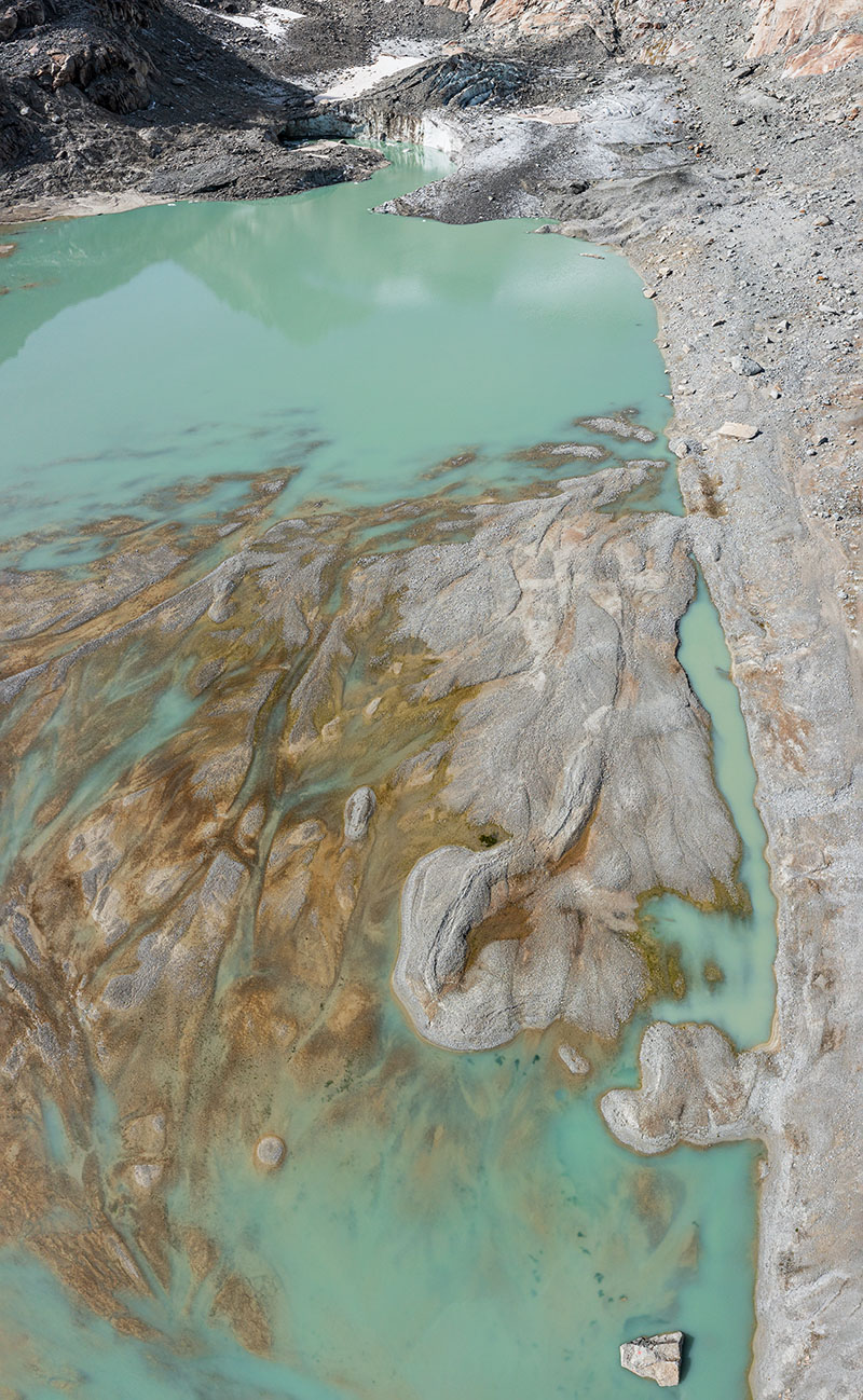 Vertical drone panorama near the deposit of glaciofluvial sediments that resemble a river delta. The meltwater stream, which has produced this formation, has shifted its course as a consequence of glacier recession (30.9.2021). | 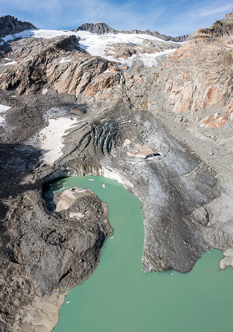 Since Tiefengletschers has receded above a steep section of terrain, only a remnant mass of dead ice still is in contact with the proglacial lake (30.9.2021). | 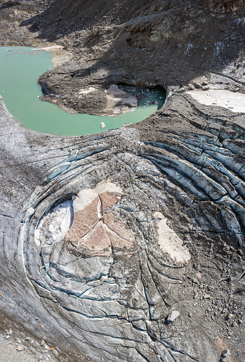 Concentric crevasses indicating collapse and calving at the front of the remnant glacier (30.9.2021). |
| Photos, unless otherwise noted: Jürg Alean. |