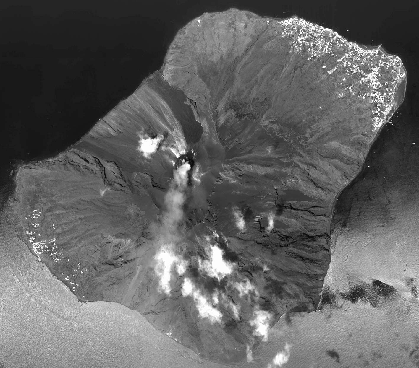
Stromboli from the air and from spaceThe four following scanner images were recorded by a «Wide Angle Optoelectronic Stereo Scanner» (WAOSS) during a test flight on 16 July 1996. A similar scanner was aboard the ill-fated Russian Mars probe Mars'96 which crashed into Pacific Ocean on 17. November1996. The image files are © and were kindly provided by Martin Scheele, Deutsche Luft- und Raumfahrt. | |||
Stromboli island (north is on the top). Larger image (250KB, ground resolution about 2 m) | Same image as on the left, but with features labeled. | Summit and crater region (north is on the bottom). Dark area below: lava flow from 1986, Pizzo is left of the white steam cloud. | San Vincenzo village (north is on the top). Top right hydrofoil craft. The other ship is a fresh water tanker (hose to coast is visible!). |
Stromboli from the northeast. Aerial photo by Bernhard Edmaier. | Summit reagion from the northeast, Upper left: Vancori, upper right: Ginostra. Aerial photo by Bernhard Edmaier. | Summit reagion and eruption of SW-crater from the southeast. Below: Rina Grande. Aerial photo by Bernhard Edmaier. | Stromboli island from about 10'000 m.a.s.l. (scheduled flight), view from the west. In front Ginostra, left Sciara del Fuoco, back Stromboli village. |
This astronaut photo take aboard International Space Station show very well the isolated location of Stromboli as the most northeastern of the Eolian Islands. Wind from the south carries Stromboli's smoke almost exactly towards the north. | |||
| Copyright is with the respective image authors. | |||