The Island
Geographical overview |
|
|
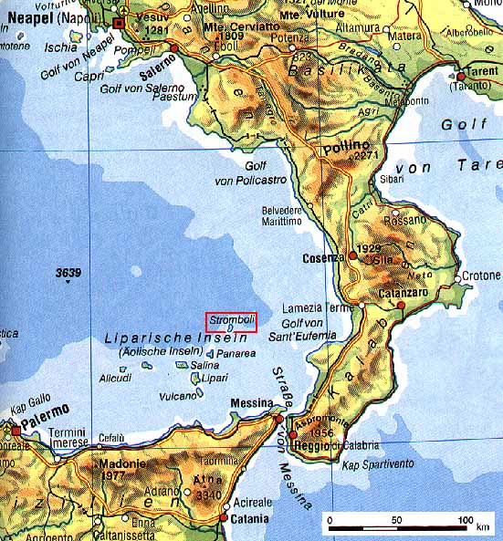
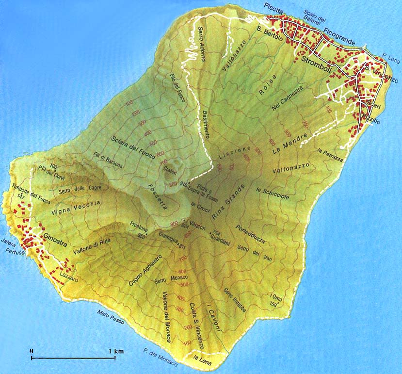
Stromboli is the northernmost of the Aeolian Islands, a group of volcanic islands located between Sicily and the southern part of the Italian mainland. The distance to the Italian mainland is 54 km, while there are 240 km to Naples (Napoli) and 55 km to Sicily. The nearest of the other Aeolian Islands is Panarea, 18 km to the Southwest (coloured map: Naples-Aeolian Islands-Catania from Diercke Taschenweltatlas, p.75, JPG:110k). Geographical coordinates: 38° 47' N / 15° 12' E Stromboli is a continuously active stratovolcano. The summit is at 924 m.a.s.l. However, the base of the volcano is between 1500 and 2000 m below the sea. The surface area of the island is only 12.6 square kilometres. Population and settlementsThere are two settlements on the island: Stromboli in the Northeast and the tiny village of Ginostra in the Southwest (coloured map of the island modified from Racheli: L'isola di Stromboli; JPG:121k). |
|
|
In 1991 the total permanent population of the island was 361. However, during the summer months there are many more residents (tourists, employees of hotels etc). The population had been much bigger during the 19th century (see graph on the left). In 1891 it had reached a maximum of 2716. In the first half of the 20th century a massive emigration took place, both to mainland Italy, and to overseas countries such as the US and Australia. |
|
EconomyFishing and agriculture (figs, vine) was most important during last century. Today food production is almost nil, and tourism is the major source of income. Punta Lena, in the Southwest part of the island, was extensively cultivated, but it is now almost abandoned. |
|